Photogramme..
.what?
Photogrammetry is the art, science, and technology of obtaining reliable information about physical objects and the environment through processes of recording, measuring, and interpreting photographic images and patterns of recorded radiant electromagnetic energy and other phenomena (Wolf and Dewitt, 2000; McGlone, 2004).
OR
Photogrammetry is looking at one point from two perspectives, just like your eyes. But through some trigonometry to measure the angular change in perspective, we can reconstruct 3d geometry from these points if we have enough of them.
The Challenge
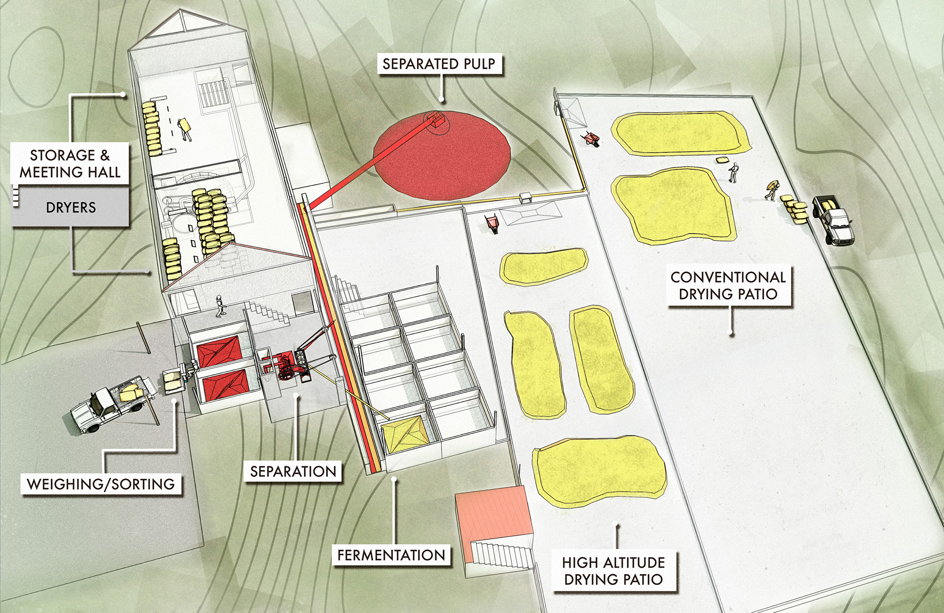
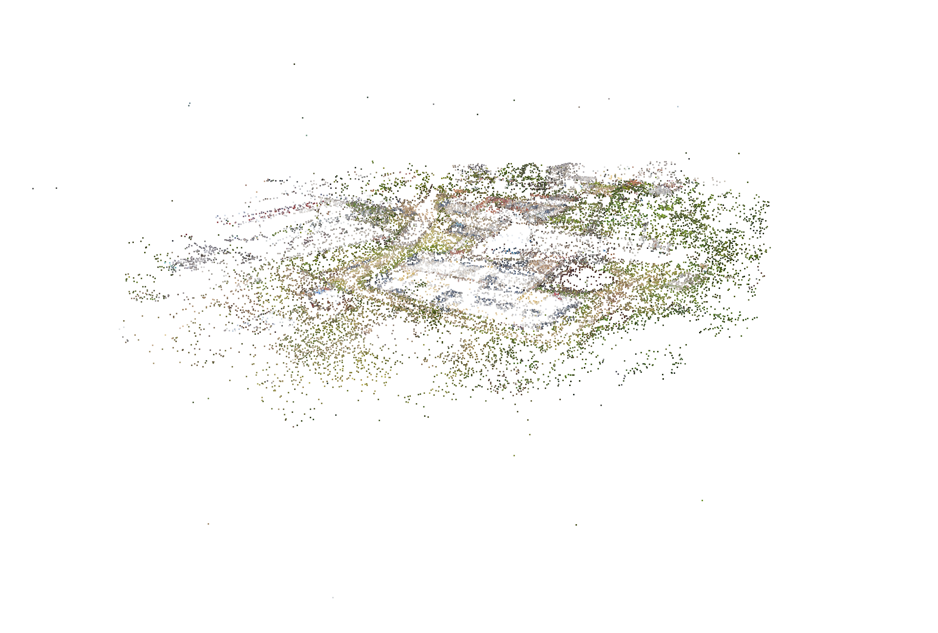
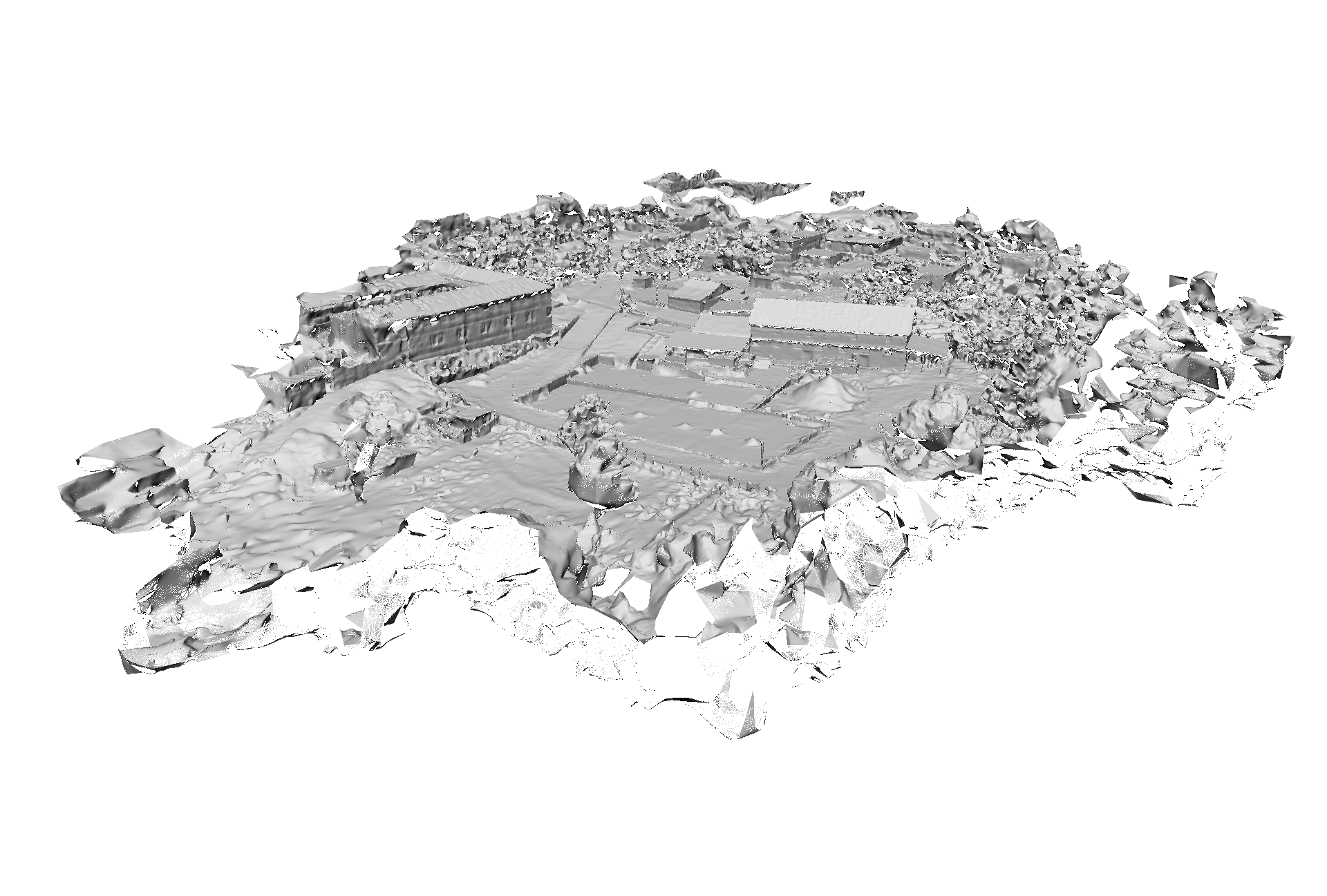
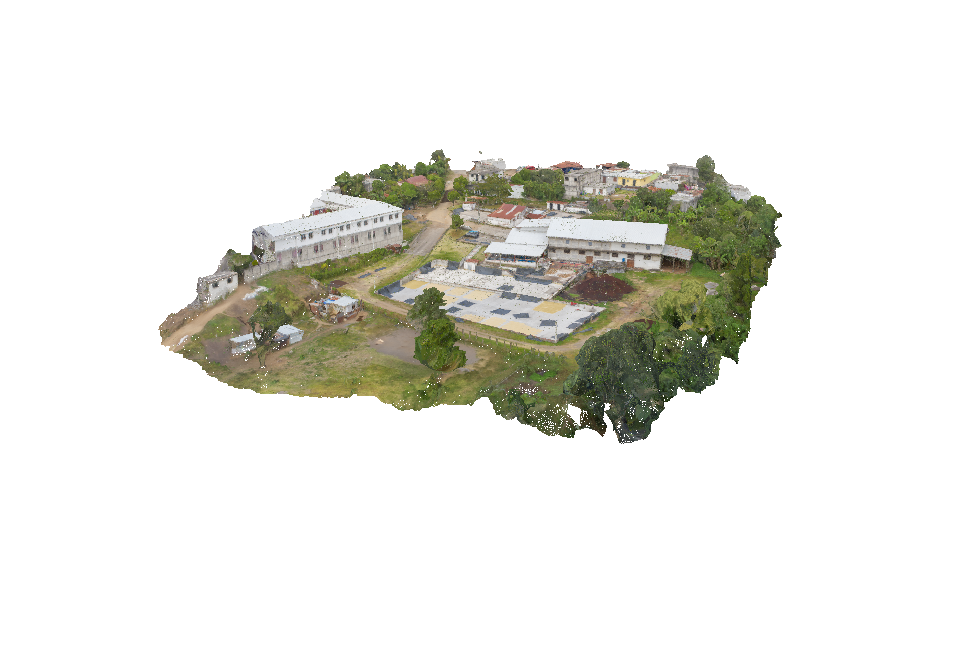
Traditional measurement and capture techniques are time consuming and labor intensive. In order to quickly model the Wet Mill for illustrative and educational uses, I needed to be able to quickly capture the data without disrupting day to day operations. To accomplish this I chose to perform an overflight with a UAV, to document and capture the site for later reconstruction and measurement.
Why use a UAV?
- Reduce field time - rapid capture
- Accurate geolocation using onboard GPS and group control points
- Capture broad areas with high detail over traditional methods
- Volumetric and capacity measurements
Total Flight Time 08:41
Billion Data Points
0
Gigapixels
0
Hectares
0
Deliverables
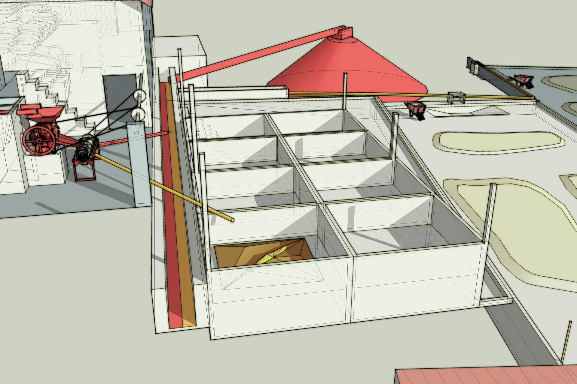
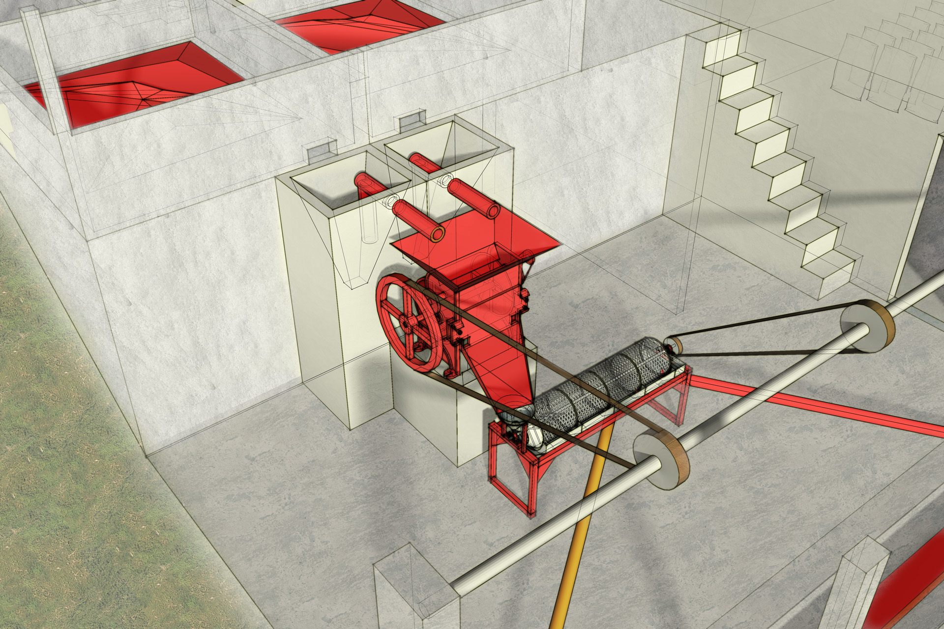
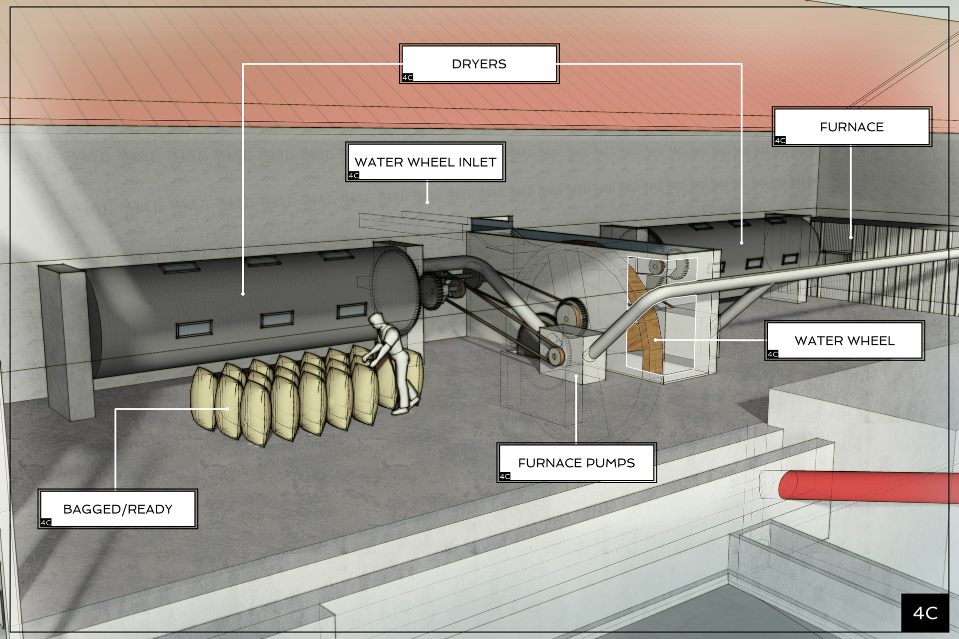
Using the photogrammetric model, I derived accurate measurements to create a 3d asset ready for production. From this model, I have created illustrative elements, digital elements to accompanying education modules, and an interactive experience that combines 360 video, photography and direct quotes from the workers at the wet mill as a multi-platform experience.
Mail US
PO Box 705
Fort Collins, CO 80522
Call or Email US
970-819-2730
devon@wave3.studio
FOLLOW US
© 2020 Wave3.studio